|
Skyroot Aerospace Flags Off Vikram-1 Payload Fairing
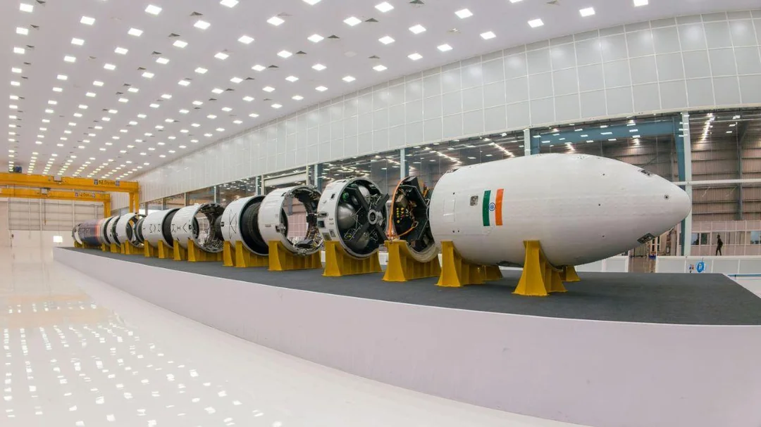
Skyroot Aerospace flags off the payload fairing of Vikram-1, marking the beginning of its launch campaign. The development is relevant for India’s private space sector and private orbital satellite launches.
Vikram-1 Launch Vehicle:
| Dimension | Key Details |
|---|---|
| Rocket Type | Vikram-1 is India’s first privately developed multi-stage orbital launch vehicle authorised by IN-SPACe. |
| Developer | Vikram-1 is developed by Skyroot Aerospace, a private company. |
| Skyroot Milestone | Skyroot Aerospace is the first private company to carry out a single-stage sub-orbital flight in 2022. |
| Launch Site | The launch site is Satish Dhawan Space Centre, Sriharikota. |
| Launch Vehicle Type | Vikram-1 is a multi-stage launch vehicle using solid, liquid, and cryogenic propulsion. |
| Height | Vikram-1 is approximately 23 metres high, equivalent to a 7-storey building. |
| Name | The launch vehicle is named to honour Dr Vikram Sarabhai, considered the father of the Indian space programme. |
| Propulsion Systems | The propulsion systems are named after Indian scientific pioneers: Kalam for high-thrust solid boosters, Raman for liquid engines, and Dhawan for the cryogenic stage. |
| Payload Capacity | Vikram-1 carries up to 350 kg to Low Earth Orbit and 260 kg to Sun-synchronous Orbit. |
| Structure | The structure is made of carbon composite instead of metals, making it lightweight, faster to assemble, and cost-effective. |
| 3D-Printed Engines | The engines are indigenously developed and 3D-printed to reduce manufacturing time and simplify assembly. |
| Launch Flexibility | Vikram-1 provides for dedicated launches, rideshare launches, and custom orbital deployment. |
| Low Earth Orbit | Low Earth Orbit has an altitude range of 160–2,000 km and is used for communication constellations, ISS, and general Earth observation. |
| Sun-Synchronous Orbit | Sun-synchronous Orbit has an altitude range of 500–800 km, near-polar inclination of 97°–99°, and is used for remote sensing, cartography, weather, and environmental monitoring. |