|
Aravalli Range
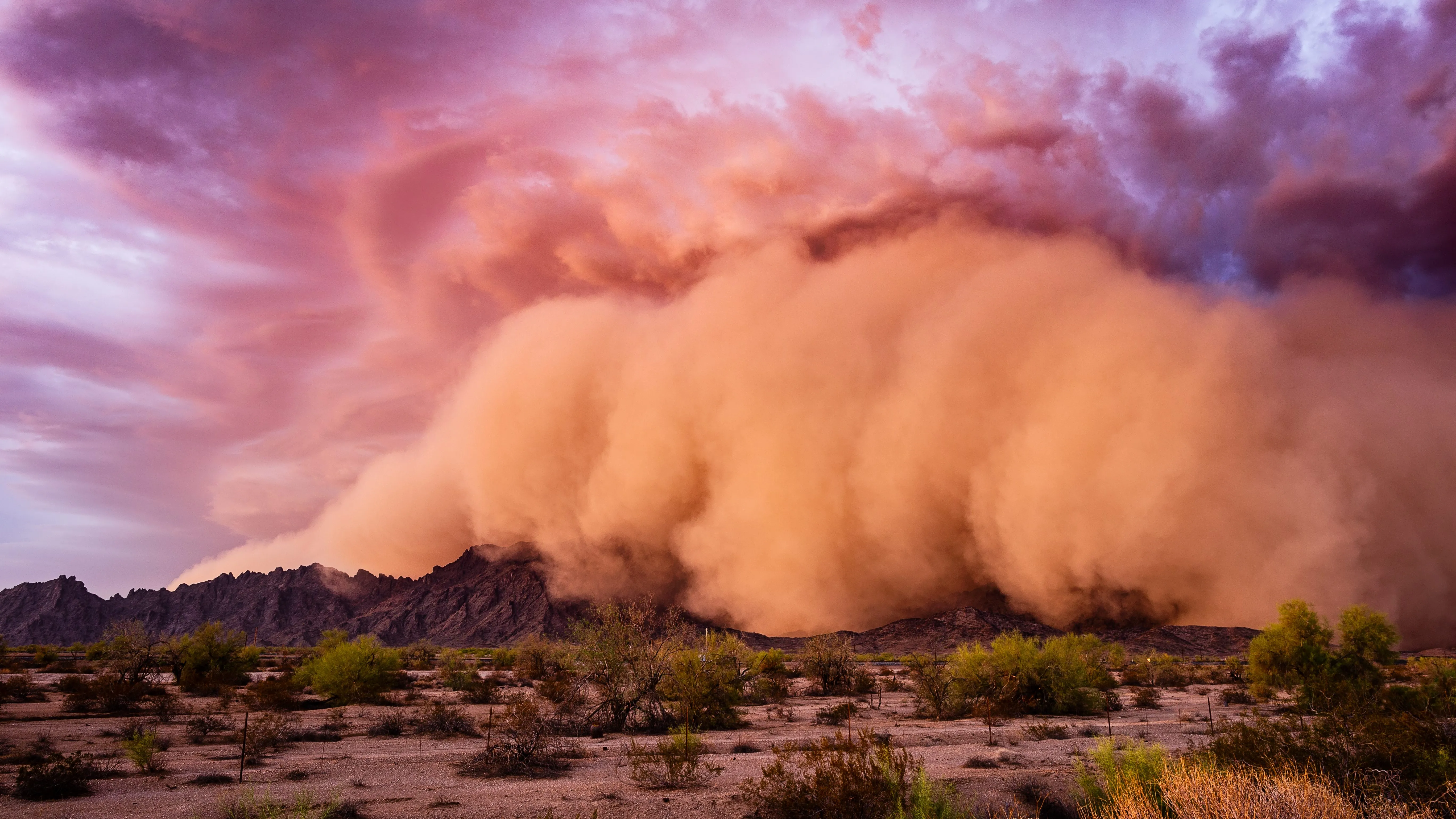
A massive pre-monsoon convective dust storm (locally termed Andhi) sweeps through Rajasthan’s Churu district, severely reducing visibility. The dust plume affects western and northern Rajasthan and spills into Haryana, Punjab, and the National Capital Region (NCR). The event brings focus to the Aravalli Range’s role as a barrier to desert dust and the reported degradation of this protective capacity.
Aravalli Range and Andhi Dust Storms:
| Dimension | Key Details |
|---|---|
| Current trigger | A massive dust storm has swept through Rajasthan’s Churu district, shrouding the sky in dust and turning day into night. |
| Local term | These pre-monsoon convective dust storms are locally termed Andhi. |
| Dust storm mechanism | Andhi is driven by intense solar heating during peak summer, which creates low-pressure centers over the Thar Desert and induces unstable convective updrafts that lift loose, dry desert topsoil into the upper atmosphere. |
| Impacted areas | Impacted areas comprise western and northern Rajasthan (Churu, Bikaner, Jaisalmer, and Sri Ganganagar), and dust plumes spill over into Haryana, Punjab, and the National Capital Region (NCR). |
| Geological type and age | The Aravallis are ancient fold mountains formed during the Proterozoic era. |
| Trend/orientation | The Aravalli range trends in a Southwest to Northeast (SW-NE) direction. |
| States/UTs covered | It stretches across 4 states/UTs: Gujarat, Rajasthan, Haryana, and Delhi. |
| Highest peak | The highest peak is Guru Shikhar, located on Mount Abu in Rajasthan. |
| Associated rivers | Rivers associated with the Aravalli range comprise Luni, Sabarmati, and Banas River. |
| Rock composition | The range is highly rich in metamorphic rocks such as quartzites, marbles, schists, and gneisses. |
| Barrier role | The Aravalli Range acts as a structural barrier between the arid Thar Desert and the fertile Indo-Gangetic Plains. |
| Physical shield function | The SW-NE alignment of the Aravalli hills physically blocks lower-tropospheric desert dust from moving eastward into the fertile agricultural belt of the Gangetic Plains. |
| Monsoon-related role | The range acts as a climatic divide: it runs parallel to the Arabian Sea branch of the Southwest Monsoon, causing western Rajasthan to remain a rain-shadow zone, while its eastern slopes intercept moisture, keeping the Gangetic basin fertile. |
| Fragmentation and gaps | The Aravalli Range is highly fragmented, featuring at least 28 documented natural gaps. |
| Human-induced degradation | Its protective capacity is actively degrading due to human-induced factors, including massive illegal mining and hill flattening that widen gaps and create wind-conduits for Thar dust storms. |
| Loss of green cover | Severe deforestation and unplanned urbanization along the foothills have destroyed the vegetative “green wall” that historically anchored shifting sand dunes. |
| Desertification impact | The weakening of this barrier accelerates the eastward creep of the Thar Desert, threatening food security of the Indo-Gangetic plains by degrading soil quality and reducing visibility across Northern India. |