|
UN General Assembly Backs Equal Earth Projection, Moves Beyond Mercator Map
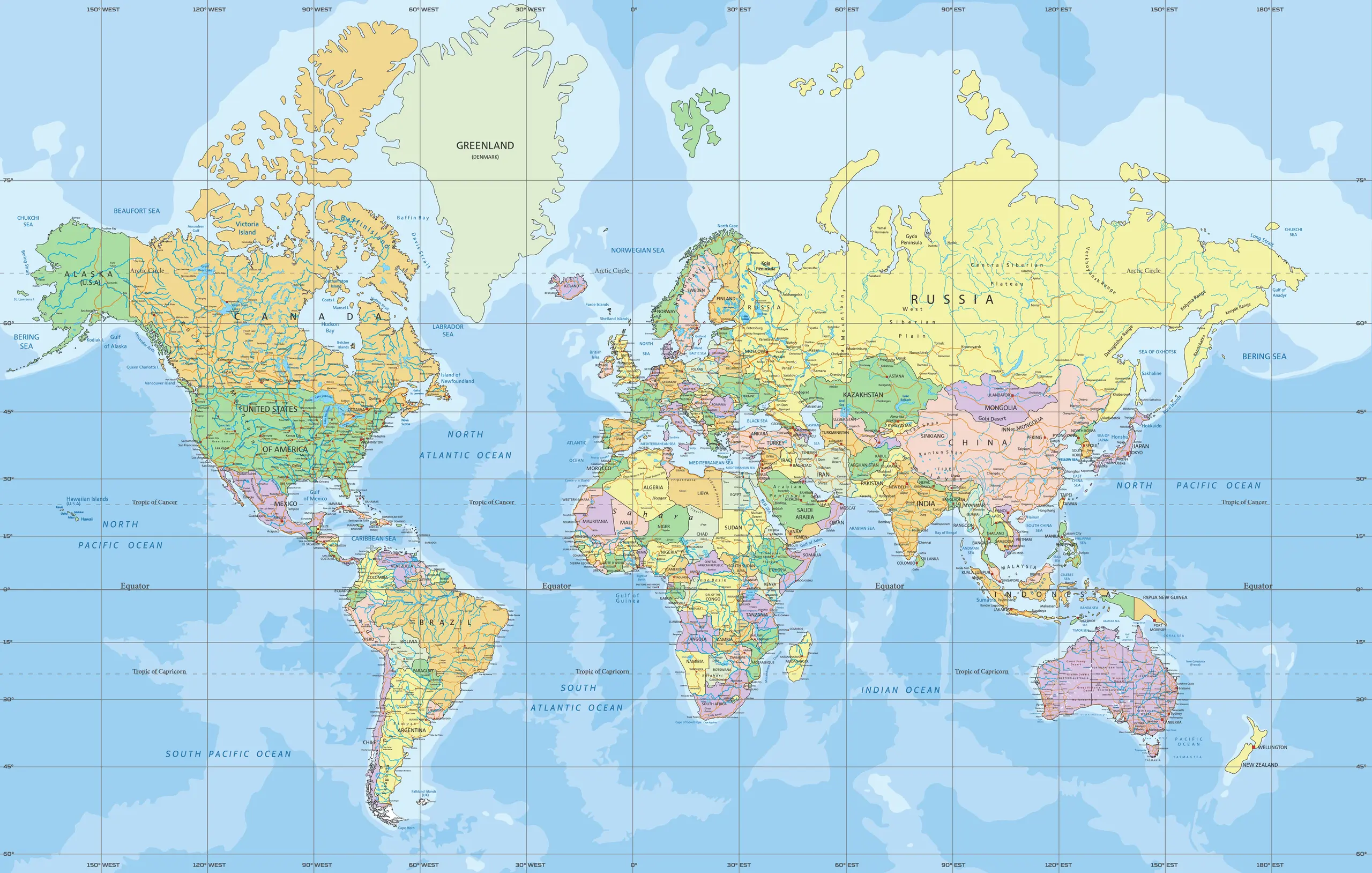
The United Nations General Assembly adopts a resolution to move away from the 16th-century Mercator map towards the Equal Earth projection for world maps and classrooms. The Togo-led resolution is supported by 164 countries, including India, while the United States votes against it and 6 countries abstain. India backs the resolution while drawing a firm line on the depiction of Jammu and Kashmir and Ladakh.
UNGA Resolution on Equal Earth Projection and Map Projections:
| Dimension | Key Details |
|---|---|
| Binding nature | UN resolutions comprise non-binding instruments. |
| India’s position | India’s support comprises a firm line on the depiction of Jammu and Kashmir and Ladakh. |
| Earth’s shape | The Earth comprises a non-perfect sphere that bulges at the equator due to spin, is warped by the Moon’s gravity, and is shaped by continents and oceans. |
| Most accurate representation | The most accurate representation comprises a spheroid, a three-dimensional shape formed from a two-dimensional ellipse. |
| Map projection | A projection comprises the transformation of the Earth’s three-dimensional surface onto a two-dimensional map. |
| Unavoidable distortions in flat maps | Every flat map comprises distortion of at least one property: area, shape, distance, and direction. |
| Projection classes by preserved property | Projections comprise four classes by preserved property: conformal (angles and local shapes, example Mercator), equal-area (relative areas, example Equal Earth), equidistant (distance), and compromise (balances distortions, examples Robinson and Winkel Tripel). |
| Mercator projection: origin and creator | The Mercator projection comprises an introduction in 1569 by Gerardus Mercator, a Flemish geographer from present-day Belgium. |
| Mercator projection: type and construction | It comprises a conformal, cylindrical projection constructed as if the Earth’s surface is unwrapped from a cylinder around the globe. |
| Mercator projection: navigation property | It comprises representation of rhumb lines, lines of constant compass bearing, as straight lines. |
| Mercator projection: grid features | The Mercator projection comprises straight-line parallels and straight-line meridians. |
| Mercator projection: distortion mechanism | On the Mercator grid, longitudes comprise even spacing, and gaps between latitudes comprise widening towards the poles. |
| Mercator projection: visual distortion examples | Mercator distortion comprises landmasses far from the equator appearing much larger; Africa appears similar in size to Greenland, while Greenland is 14 times smaller and roughly the size of the Democratic Republic of the Congo, and Antarctica appears far larger than its true size. |
| Gall-Peters projection | Gall-Peters comprises first presentation by Scottish clergyman James Gall in 1855 and popularisation by German historian Arno Peters in 1973, and it preserves area accurately while making landmasses look stretched or squashed. |
| Robinson projection | The Robinson projection comprises a 1963 design by geographer Arthur H. Robinson as a compromise projection, with meridians curving gently towards the poles. |
| Winkel Tripel projection | The Winkel Tripel projection comprises a 1921 creation by German cartographer Oswald Winkel, and it has replaced the Robinson projection in 1998 in National Geographic Society maps. |
| Equal Earth projection: development | The Equal Earth projection comprises development in 2018 by an international team of cartographers. |
| Equal Earth projection: type and trade-offs | It comprises an equal-area projection that preserves relative areas of landmasses while allowing some distortion of shape and distance. |
| Equal Earth projection: geometry | It comprises meridians that curve gently towards the poles. |
| Equal Earth projection: best-suited use cases | Equal Earth comprises suitability for thematic and statistical data, including population density, climate impacts, and resource distribution. |
| Projection selection by purpose | Map-use choices comprise conformal projections like Mercator for navigation and direction, equal-area projections like Equal Earth for thematic and statistical data, compromise projections like Robinson or Winkel Tripel for general reference and world maps, and azimuthal or planar projections for polar or single-point studies. |
| Adoption in practice: World Bank | The World Bank comprises use of Winkel Tripel or Equal Earth for static maps and has been phasing out Mercator on web maps. |
| Adoption in practice: Google Maps | Google Maps comprises a choice between Mercator and a 3D globe view on desktop, and Mercator comprises the default on its mobile app. |