|
Meghalaya Records India’s Highest 2026 Southwest Monsoon Rainfall Deficit
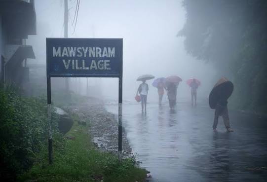
Meghalaya records the highest rainfall deficit in India during the 2026 southwest monsoon, with several districts showing large departures from normal rainfall. East Khasi Hills, West Jaintia Hills, and Southwest Khasi Hills figures are reported, alongside concerns linked to agriculture and spring-dependent water use.
Meghalaya Southwest Monsoon Rainfall:
| Dimension | Key Details |
|---|---|
| Rainiest places and location | Mawsynram and Cherrapunji are located in Meghalaya's East Khasi Hills, and are recognized as some of the rainiest places on Earth. |
| East Khasi Hills rainfall departure | East Khasi Hills experiences a 53% rainfall deficit during the 2026 monsoon season. |
| West Jaintia Hills rainfall departure | West Jaintia Hills records the highest rainfall deficit at the district level, amounting to 79%. |
| Southwest Khasi Hills rainfall departure | Southwest Khasi Hills is the only district with excess rainfall, and as of 15 September, rainfall is 58% above normal levels. |
| Primary vulnerability cited | Agriculture in Meghalaya largely depends on rainfall, which sustains streams and springs that provide irrigation and support crop production. |
| Spring dependence | Approximately 80% of villages depend on springs as their primary sources of drinking water and irrigation. |
| Human activities linked to spring impacts | Human activities contributing to drying or reduced discharge of springs comprise mining, unsustainable agricultural practices, and forest resource extraction. |
| Reported spring impact magnitude | Approximately 50% of springs are reported as drying or having reduced discharge, as per the cited MBDA conference paper. |
| Working population and agriculture | Approximately 77% of Meghalaya's working population is engaged in agricultural activities. |
| GSDP share | Agriculture accounts for approximately 21% of the state's gross domestic product. |
| Cropped area share | The total cropped area constitutes 15.28% of the state's geographical area. |
| Approximate cropped area | The approximate cropped area is 343,000 hectares. |
| Net irrigated area | The net irrigated area is limited to 31,796 hectares. |
| IMD study period and finding | An IMD 30-year analysis (1989-2018) finds a significant decreasing trend in monsoon rainfall in Meghalaya. |
| SAPCC publication and period | The Meghalaya State Action Plan on Climate Change (SAPCC) is published in 2025, and the plan period is 2023-2030. |
| SAPCC priority areas | Agriculture and related sectors are among the 8 priority areas identified for climate change mitigation and adaptation planning. |